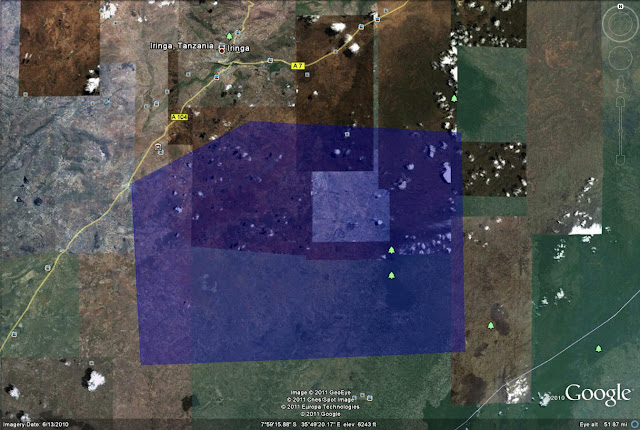
Even a few years removed from my trip I have a pretty good mental map of the area. When I returned home I estimated the location based on blurry images of maps, estimated travel times, and the turns I remembered on our ride from Iringa to Pommern. I thought I was close, but the imagery was so bad that I had no way of knowing. Now I've lost that Google place mark and so it's like starting from scratch.
This weekend I discovered that the majority of the Iringa Region in Tanzania has new, clear, crisp imagery for a large area.
Up to this point it has been unbelievably difficult to locate the village. While the other village in Tanzania associated with Global Volunteers (Ipalamwa) shows up, Pommern never has. Given that I was teaching geography and computers in Pommern it's frustrating that it's nearly impossible to locate the village in Google Earth. Although it's not as if there is internet in Pommern. For that you need to go to Iringa, where the chicken is much smoother.
I found a Facebook Group that said the secondary school, which I worked at, is 58KM from Iringa. I'm inclined to believe that distance is via the road network. Going out 58KM as the crow flies would lead into the adjacent Region of Morogoro.
I knew that Pommern was in the Kilolo district of Iringa, one of seven districts but I can't find any maps that show those district lines. That is particularly disappointing. I guess the internet is not yet complete.
I've challenged myself to find Pommern and locate it for others. Based on the information I've gathered I've developed a very generous search area of approximately 1,000 square miles. I'm very confident that Pommern is within the search area.
 Admittedly, this seemed like a much easier endeavor when I first drew the search area. It's sort of like being able to stumble upon my subdivision from a map of metro Detroit.
 When I do find it I'll be able to greatly increase the accuracy of some geotagged photos in the area. Bonus!
It's quite a challenge but I think I have it in me and THAT means next week you can bet there will be a post and a link to all the features I've found and remembered. Hopefully it will give more of a voice and online presence to a great area, a great Place.


Did you try Wikimapia?
ReplyDeleteGood idea, but still no luck. I'll try to add it once I locate it.
ReplyDelete